How to Find Free Dispersed Camping on Public Lands

Understanding the Landscape: Where Free Camping Lives
Before you start punching coordinates into your GPS, you need to understand who owns the land beneath your tires. The United States is a patchwork of federal, state, and private ownership, and only certain categories welcome dispersed camping without charging a fee.
Bureau of Land Management (BLM) lands are your best friend. Covering roughly 245 million acres—mostly across the Western states—these vast stretches of desert, grassland, and forest allow dispersed camping unless specifically posted otherwise. The BLM manages land for multiple uses, and recreation falls squarely within that mandate. You can typically camp up to 14 days within any 28-day period on BLM land before you need to relocate at least 25 miles away.
National Forests operate under similar rules. With 154 national forests and 20 grasslands spanning 193 million acres, the opportunities are staggering. The Forest Service generally permits dispersed camping anywhere outside developed campgrounds, recreation areas, and sensitive ecological zones. The same 14-day limit applies, though enforcement varies by district.
Wildlife Management Areas, state forests, and some state trust lands also offer free dispersed camping, though regulations vary dramatically. Some require permits. Others prohibit camping during hunting seasons. A few western states—Arizona, New Mexico, Colorado, and Wyoming among them—have particularly permissive state land policies for dispersed camping.
Private land is never an option without explicit permission. No exceptions. Posted or not, camping on private property constitutes trespassing. The courtesy of a knock on a farmhouse door has saved many road-trippers from a midnight confrontation.
The Digital Toolkit: Mapping Your Escape
Gone are the days of squinting at paper USGS quadrangles at the library. Modern dispersed camping requires a smartphone, some savvy, and a handful of essential apps.
Gaia GPS remains the gold standard for backcountry navigation. The app overlays multiple map layers—MVUM (Motor Vehicle Use Maps) for national forests, BLM surface management status, and satellite imagery. The MVUM layer is particularly crucial: it shows exactly which roads are open to vehicles and where dispersed camping is legally permitted. A premium subscription unlocks the full catalog of layers, but the free version handles basic trip planning admirably.
Campendium and iOverlander crowdsource camping locations with user-submitted coordinates, photos, and reviews. These are starting points, not destinations. A pin on iOverlander marked "amazing spot" in 2019 may have been gated, developed, or trashed by 2025. Cross-reference everything.
FreeRoam offers a clean interface specifically designed for dispersed camping discovery, with filters for cell coverage, weather, and public land boundaries. The satellite view with BLM and Forest Service boundaries overlaid saves hours of cross-referencing.
For the methodical planner, the Forest Service's official Motor Vehicle Use Maps remain the definitive legal document. These PDFs—available on each national forest's website—show every legal road and designate which allow dispersed camping. Download them before you lose signal. Screenshot the relevant pages. Murphy's Law applies doubly to backcountry navigation.
The Satellite Reconnaissance Method
Once you've identified promising public land, switch to Google Earth or Google Maps satellite view. Look for clearings, flat spots, and existing fire rings—the telltale sign that others have camped there before. Established sites reduce your impact and usually indicate decent vehicle access.
Study the approach roads carefully. That flat meadow might require crossing three miles of washboard ranch road or fording a creek that becomes impassable after rain. Elevation profiles matter: campsites above 8,000 feet may be snowbound well into June. Southern aspects dry faster. Northern slopes hold snow and mud.
On-the-Gound Tactics: Reading the Terrain
Digital preparation only takes you so far. The real skill of dispersed camping lies in knowing what to look for when the pavement ends.
Start by identifying secondary roads—those thin gray lines on Forest Service maps that branch off maintained gravel routes. These often lead to established dispersed sites. Look for pullouts, flat terraces, and areas where vegetation has been compacted. If you spot a fire ring constructed from local stones, you've found a previously used site. Use it rather than creating impact elsewhere.
Distance from water requires careful attention. Federal regulations typically prohibit camping within 200 feet of lakes, streams, and springs. This isn't bureaucratic fussiness—it's biology. Riparian zones are fragile ecosystems, and human presence degrades water quality for wildlife and downstream users. Carry a walking stick or use your trekking pole to measure roughly 70 large steps from the high water mark before selecting your site.
Weather considerations separate experienced dispersed campers from the miserable. Avoid dry washes and arroyos in the desert Southwest—flash floods kill more campers than wildlife. In mountainous terrain, study the tree canopy. Dense, uniform stands suggest stable ground. Patches of leaning, mismatched trees may indicate unstable slopes or previous avalanche activity.
The Art of the Arrival
Timing matters. Arrive with at least three hours of daylight remaining. Dispersed sites have no signage, no numbered posts, and no hosts to direct you. You'll need time to evaluate multiple options, and the stress of nightfall pressing against your windshield clouds judgment.
When you locate a promising spot, exit your vehicle and walk the full area. Look for evidence of previous human use: flattened grass, charcoal stains, scattered aluminum foil. These established sites recover slowly—sometimes requiring decades—so concentrate your impact where impact already exists.
Check your cell signal if connectivity matters to you. Walk in circles, testing different elevations. Sometimes twenty feet of lateral movement transforms "searching" into three bars of LTE. Mark this spot with a cairn or flagging (removed before departure) so you can return to it during your stay.
Regulations, Permits, and the Bureaucratic Reality
Free dispersed camping doesn't mean regulation-free camping. Understanding the rules prevents expensive citations and protects the resource for future travelers.
The 14-day rule dominates federal land management. On most BLM and National Forest land, you may occupy a single site for 14 days within any 28-day period. After that, you must relocate at least 25 miles away. Enforcement is inconsistent—some districts monitor heavily, others are essentially unpatrolled—but the regulation exists to prevent squatting and resource damage.
Group size limitations apply in many areas. The standard is 75 people and 15 vehicles for overnight stays, though specific locations may restrict further. If you're organizing a gathering, contact the district office.
Fire restrictions change seasonally and sometimes daily. During dry periods, all open flames—including campfires, charcoal grills, and sometimes even propane fire pits—may be prohibited. Check the current fire restrictions on the relevant agency website before departure. Ignorance isn't a defense, and a citation for an illegal campfire during Red Flag conditions runs into hundreds of dollars.
Some areas require free permits or self-registration even for dispersed camping. The rules are posted at district boundaries or trailheads. Fill out the forms. The data helps land managers advocate for recreation budgets, and the process takes ninety seconds.
Leave No Trace: The Non-Negotiables
Dispersed camping's privilege depends entirely on collective behavior. One careless camper closes roads, gates access, and ruins opportunities for everyone. The Leave No Trace principles aren't suggestions—they're the social contract that keeps public land public.
"The best campsites are found, not made." — Leave No Trace Center for Outdoor Ethics
Camp on durable surfaces: established sites, rock, gravel, or dry grasses. Avoid delicate cryptobiotic soil crusts common in the desert Southwest—these living organisms stabilize soil and fix nitrogen, and a single footstep can destroy decades of growth.
Pack out everything. Everything. That includes toilet paper, orange peels, and apple cores. If you didn't drop it from your body before arriving, it doesn't biodegrade in a timeframe relevant to the next camper. Bury human waste 6-8 inches deep at least 200 feet from water sources. In high-use areas, consider packing out solid waste in WAG bags.
Dismantle all fire rings when you depart. Scatter the stones. This practice seems counterintuitive—shouldn't the next camper benefit from your fire ring?—but accumulated rings multiply, creating unsightly impact zones that land managers eventually close to camping. One ring per site, dismantled after use, keeps dispersed camping looking dispersed.
Troubleshooting: When Plans Fail
Not every expedition succeeds. Gates close. Roads wash out. Promising satellite coordinates lead to no-trespassing signs. Adaptability separates weekend warriors from seasoned dispersed campers.
Always identify backup options before departing cell service. I maintain a list of three potential sites for any given region, ranked by preference and separated by enough distance that a closure affecting one won't impact the others.
If your preferred site is occupied—and established dispersed sites often are during peak season—resist the temptation to create a new site nearby. Drive farther. Explore secondary roads. The solitude you seek requires separation, and crowding existing sites degrades the experience for everyone.
Weather changes rapidly in the backcountry. That sunny forecast updates to thunderstorm warnings. Elevation becomes your tool: climb to escape heat, descend to avoid lightning, seek southern exposures for early-season warmth. A dispersed camper reading the sky beats any weather app for local prediction.
The Deeper Reward
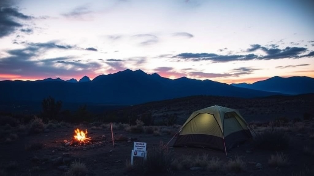
Finding free dispersed camping requires effort, research, and flexibility. The payoff isn't merely financial—though saving $30-50 nightly adds up quickly. The real compensation arrives with sunset, when you realize the nearest artificial light is thirty miles distant and the Milky Way has begun its nightly performance overhead.
These public lands belong to you. Learning to locate them, access them responsibly, and disappear into them honors both the resource and the generations of advocates who preserved it. Build your fire small. Watch it carefully. Leave nothing but compressed grass and the memory of a perfect night under open sky.
Steps
- 1
Research Public Land Areas Using Official Maps and Apps
- 2
Check Local Regulations and Fire Restrictions Before You Go
- 3
Practice Leave No Trace Principles and Camp Responsibly